Use APKPure App
Get ThurGIS edit old version APK for Android
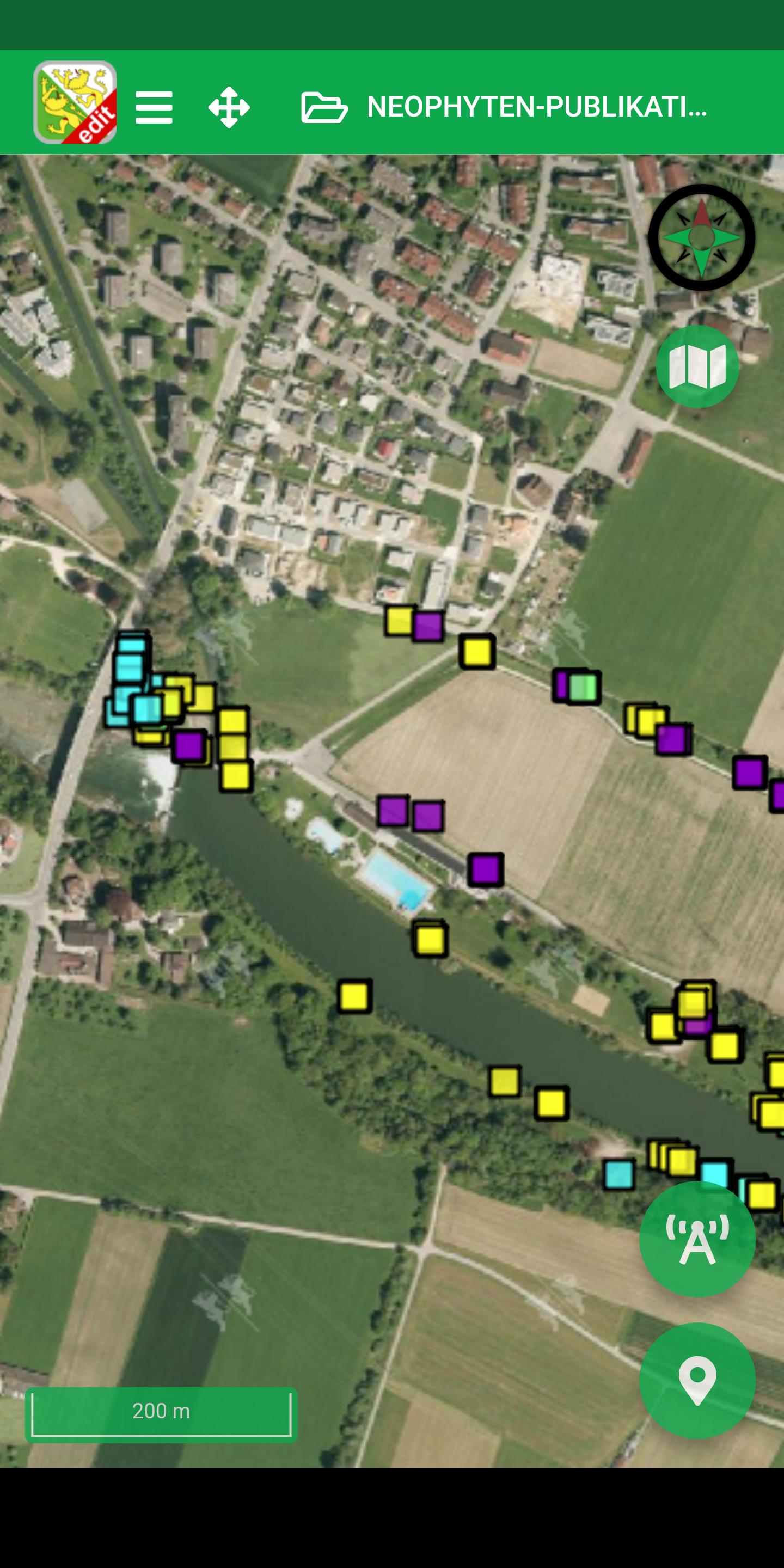
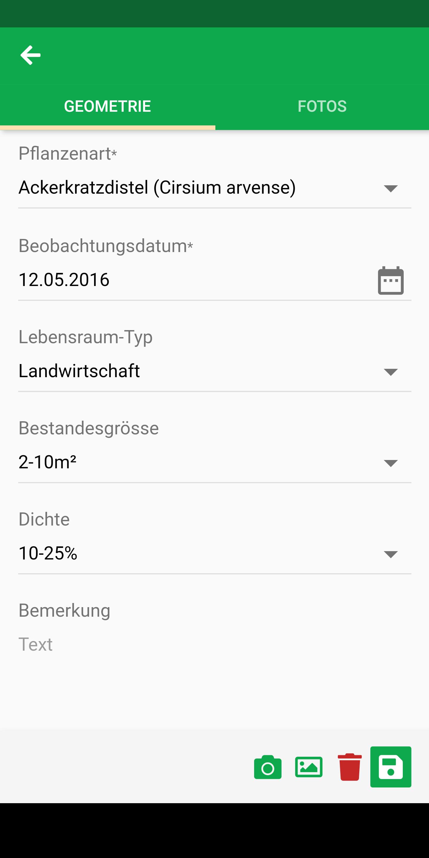
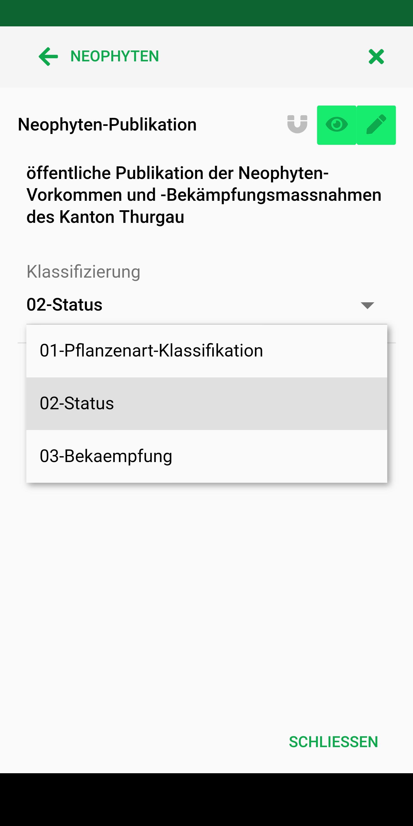
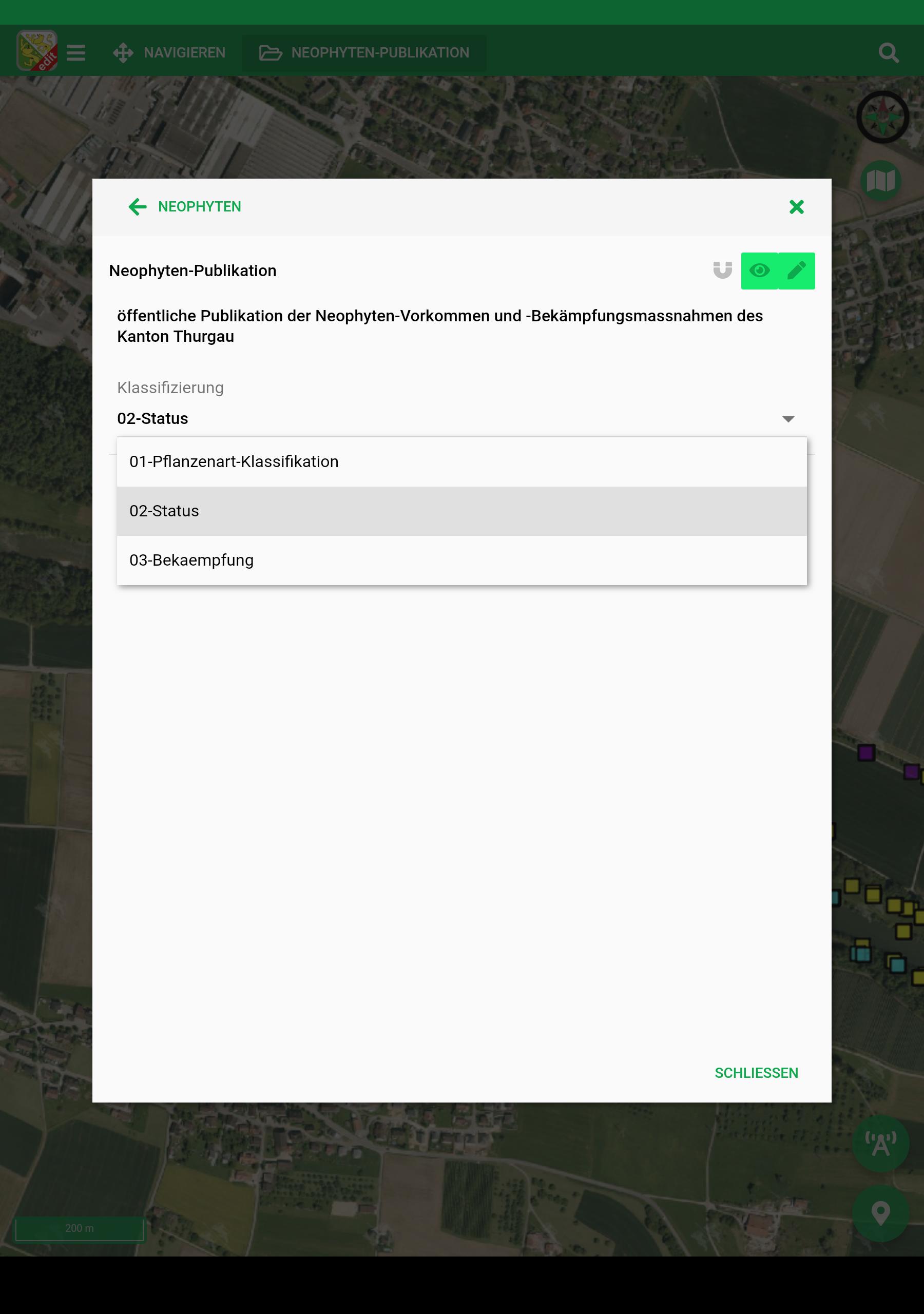
With the ThurGIS edit App authorized users can capture spatial data out in the field
With the ThurGIS edit app, authorized users can enter geodata of specific topics on the move and on site.
Welcome to the geographic information platform of the Canton of Thurgau. ThurGIS is the abbreviation for "Thurgau Geographic Information System" and offers you two-dimensional views with georeferenced and interactive maps.
Edit stands for editing, so that new geodata can be recorded and changed.
In order to be able to record geodata for a specific topic, the user needs a user account which he can apply to the Office for Geoinformation.
Hints:
==========
* The maps and geodata offered are limited to the Canton of Thurgau
* Only geodata in the canton can be recorded
* A mobile data connection is required to use the ThurGIS edit app. There may be fees
Features:
==========
* Acquisition and processing of point, line and surface geometries, including information on them
* Capture photos per geometry directly in the app
* Measure distance and area
* Different background map views: orthophoto, open street map
* Search for locations
* GPS localization
* Offline use
This app is based on Sabretooth from Kaden & Partner AG https://www.sabretooth.ch
Last updated on Nov 19, 2022
* neu: Zuletzt gezeichneter Stützpunkt entfernen
* bug fix: Offline-Mode: Geometrien in mehren Offline Ausschnitten werden nun nur noch einmal heruntergeladen
* bug fix: Zur aktuellen Position zoomen wenn die Position noch die gleiche ist
* bug fix: Multi-Edit: neue Datensätze in Datentabelle für alle Geometrien erstellen
Latest Version
![]() 3.9.0
3.9.0
Uploaded by
Jhon Leo Meraña Llarena
Requires Android
Android 7.0+
Available on
![]()
Category
Report


Discover what you want easier, faster and safer.

ThurGIS edit
3.9.0 by Kaden & Partner AG
Nov 19, 2022