Use APKPure App
Get Royal Blue ATV Trails old version APK for Android
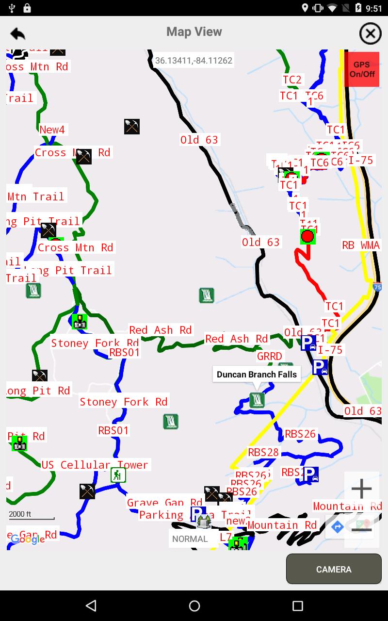
Percorsi e punti di interesse all'interno e intorno alla Royal Blue Wildlife Management Area (a ovest della I-75)
Lifetime maps, pay only once, no annual fee, no in-app purchases, and updates are free. Over 240 miles of trails and 163 Points of Interest. Local Company. See the trails in and around the Royal Blue Wildlife Management Area (WMA) located near Exit 141 on the WEST side of Interstate I-75 in Tennessee, which is between Caryville, TN and up toward the Hunstville Highway (63). There are over 100 miles of maintained trails in this system. Included are Points of Interest (POIs) such as Waterfalls, Views, Cascades, and other interesting places in this Trail System. Royal Blue WMA used to be on both sides of I-75, but with additional areas added, they split the Royal Blue WMA into two pieces. The Royal Blue WMA is now the area West of I-75 and Sundquist WMA is on the East side of I-75. See my Sundquist ATV Trails on the Play Store. The WMA also has the New River WMA on the West side of I-75 as well. There are two Private Trail Systems on the West side as well, called Brimstone, and Windrock (also known as Coal Creek). An app for some of these will be released soon as well. You will be able to see which trail you are on, and, at intersections, which trails are ahead, so you can make decisions as to which way you want to go. Most trails in this system have numbers, which are displayed on the map. If you touch one of these Trail Numbers, it will display the Trail Name. Where the trail has no number, the Trail Name was used as a Trail Number as well. If you touch a POI Symbol, you will see the name of the POI. You cannot say I am here, and I want to go there. It will not do that. Also, the Trails are in various colors. Generally, if the trail is Green, it is Easy, if it is Blue, it is generally Moderate, and if it is Red, it is Difficult. Any trail can be different from its color as to difficulty do to weather or wind and the colors are just meant to be a guide. You are responsible if you ride on a trail your vehicle is not capable of, or that is beyond your capability. The app is just meant to help you find your way around. There are a small number of trails., less than 5%, that are not gathered at the time of release, but the majority of them are included. See also on the play store my FREE App that gathers Trails called ATV Trail Creator.
If you do not have an Android, you can buy a new or used one, you do NOT have to have a phone number in it. Go to Settings, Location and look for the work GPS. if you see it, that device should work with this App. You need WiFi (or a phone number) to download the App, but after that the App just needs the GPS. Some Tablets have a GPS.
Last updated on May 28, 2021
Minor bug fixes and improvements. Install or update to the newest version to check it out!
Ultima versione
![]() 1.6
1.6
È necessario Android
4.1
Available on
![]()
Categoria
Segnala


Discover what you want easier, faster and safer.

Royal Blue ATV Trails
1.6 by GPSAppGenerator, LLC
May 28, 2021
$14.99