Use APKPure App
Get 路線図プラス old version APK for Android
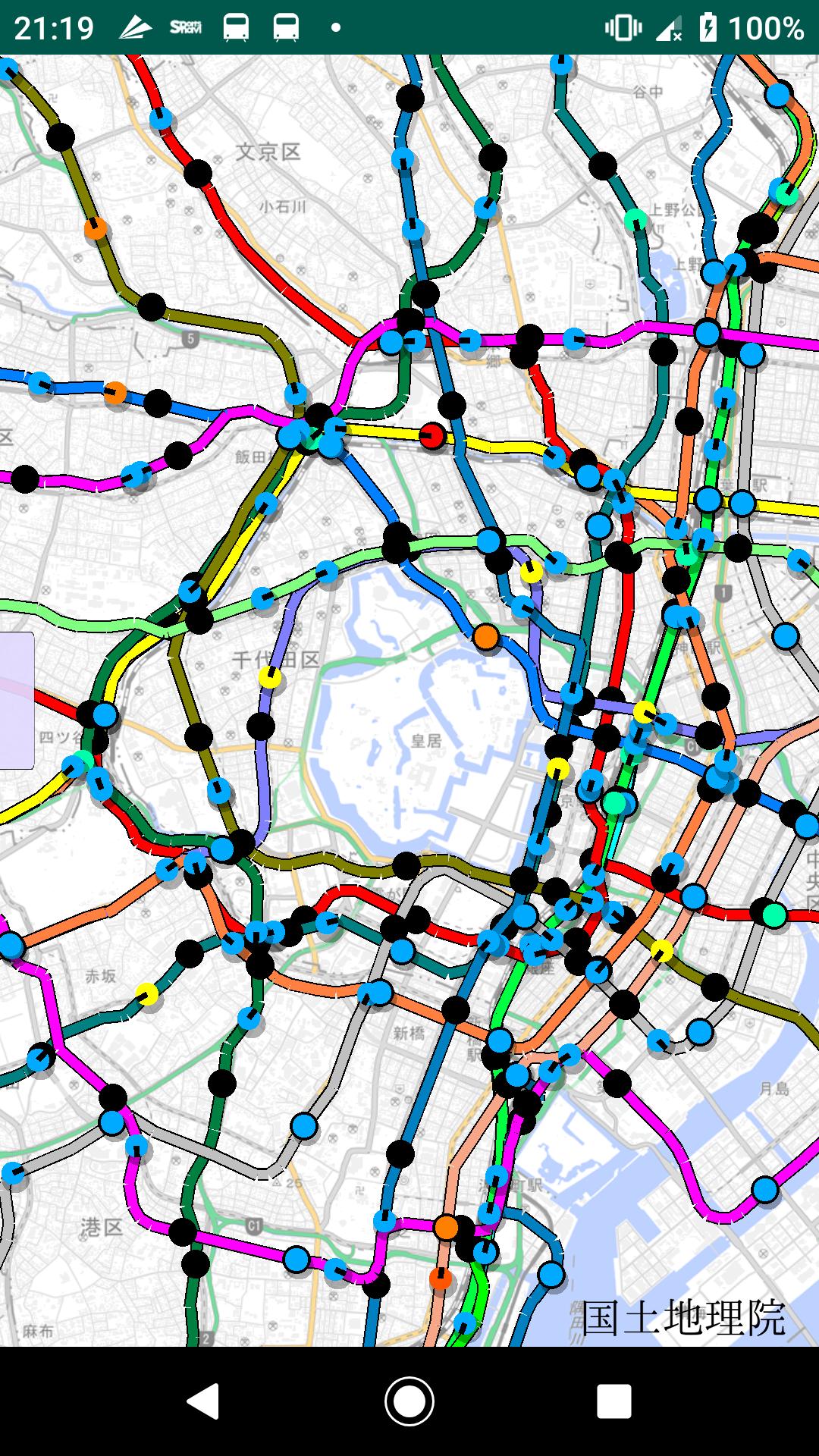
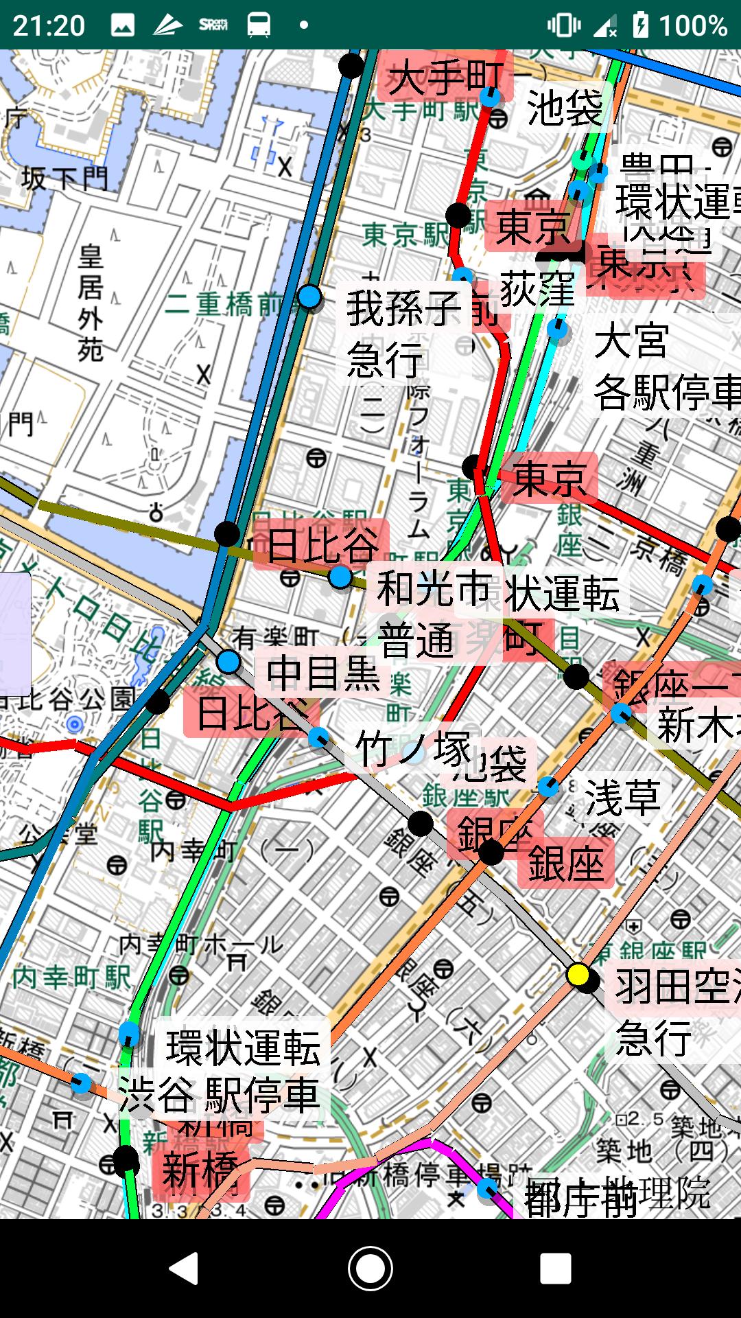
Railway lines and bus routes are displayed on the map Expressed to the position where the vehicle is traveling Up to the timetable for the station information
Overlay the map of transportation in your town or in a land you do not know
Since it overlaps with the map, it is easy to see where you will pass
In addition, the vehicle position is displayed according to the timetable, so it is easy to understand how often the route is.
The route of each train is also displayed on the map for easy viewing
You can schedule your trip or just enjoy watching it.
It is OK to assume noise along the railway line
Can also be used for random train and bus trips
Use for commuting to work, school, or wherever you go for the first time
In addition, we will inform you of major railway delay information.
Footprint function
You can leave a footprint at the station and check it later.
It is supposed to be used like a diary.
This function can only be used by logged-in users, so please try logging in. Footprints are invisible to others.
Footprint data is managed on the server, so you can continue to use it even if you buy a new smartphone.
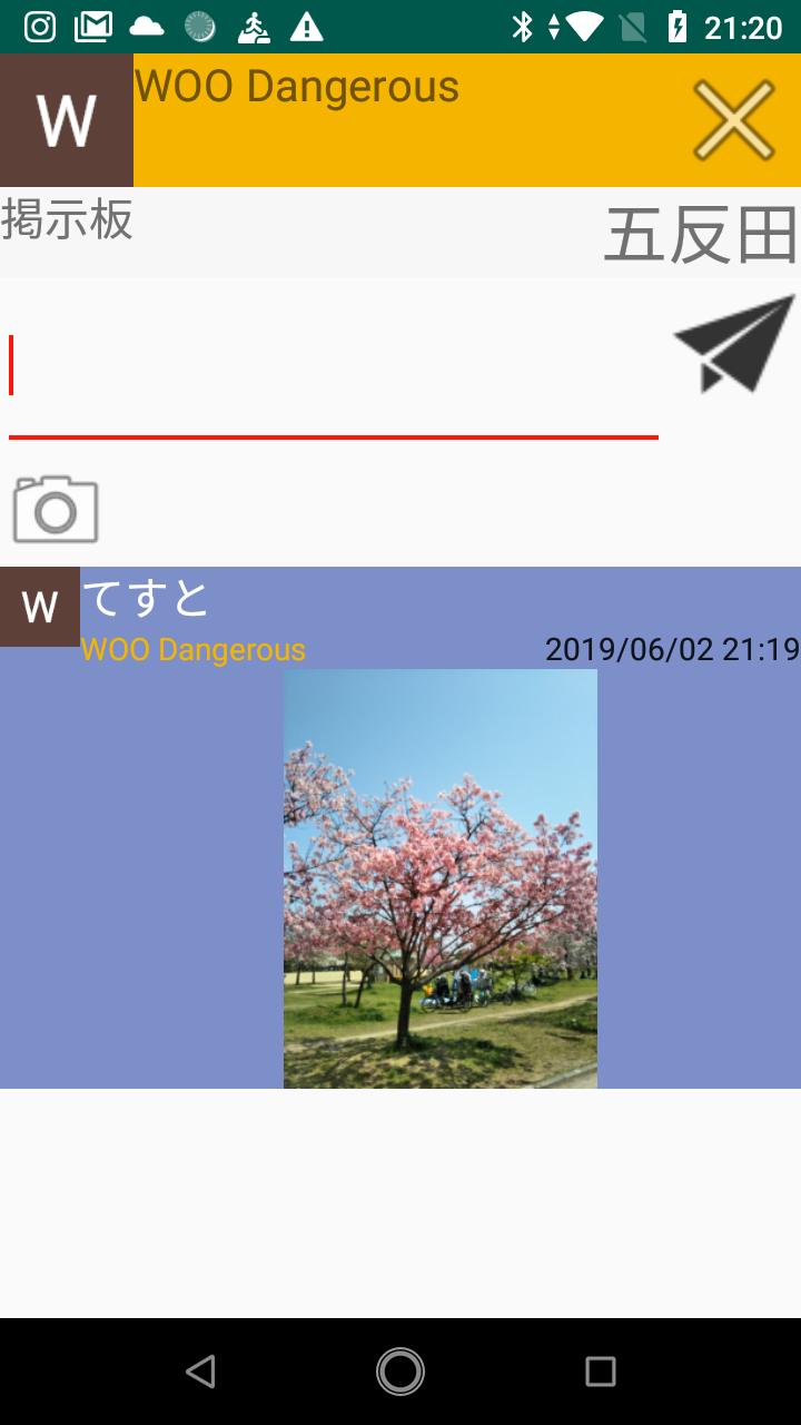
Image posting bulletin boards and live broadcasts are set up at each station.
You can leave a message by logging in, so you can freely post what happened at the station or what you want to know with an image.
The message will be deleted in a week. Only one message can be written by one user per station.
The location information is near the station, and you can use the live broadcast distribution function by logging in. Anyone can watch the live concert.
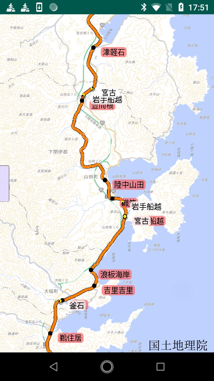
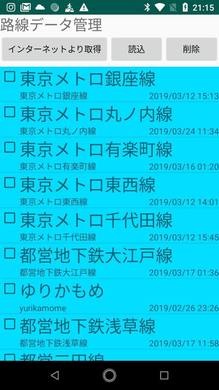
Route data can be obtained from the Internet.
Data that is not prepared can be created and published on a personal computer.
If you are a delusional person, you can run it by creating a route map data of a fictitious railway.
https://twitter.com/WhereTrain
·Overview
This app is a map app that shows the current position of the train at a glance.
Calculates and displays the assumed position based on the timetable.
Unfortunately, the position of delay etc. cannot be expressed because it cannot be calculated, but the RSS is picked up and the station of the target line blinks red.
You can also check the content of the notification, so please use it.
The data is created in open source called "Where Train Build".
The created data can be loaded from the app by registering it in WhereTrainHUB.
You can also import data that you do not want to publish by uploading it to Google Drive.
WhereTrainHUB
https://wheretrainhub.live-on.net/
WhereTrainBuild
https://ja.osdn.net/projects/wheretrainbuild/
・ How to use
First, load the route data.
There is a slide bar on the left, so move the knob on this bar to the right to bring up the menu.
Press the green "Route data" to move to the loading screen.
Click the Get button from the Internet to load the data from WhereTrainHUB.
It will take some time to load the route data. It will be displayed automatically when loading is completed.
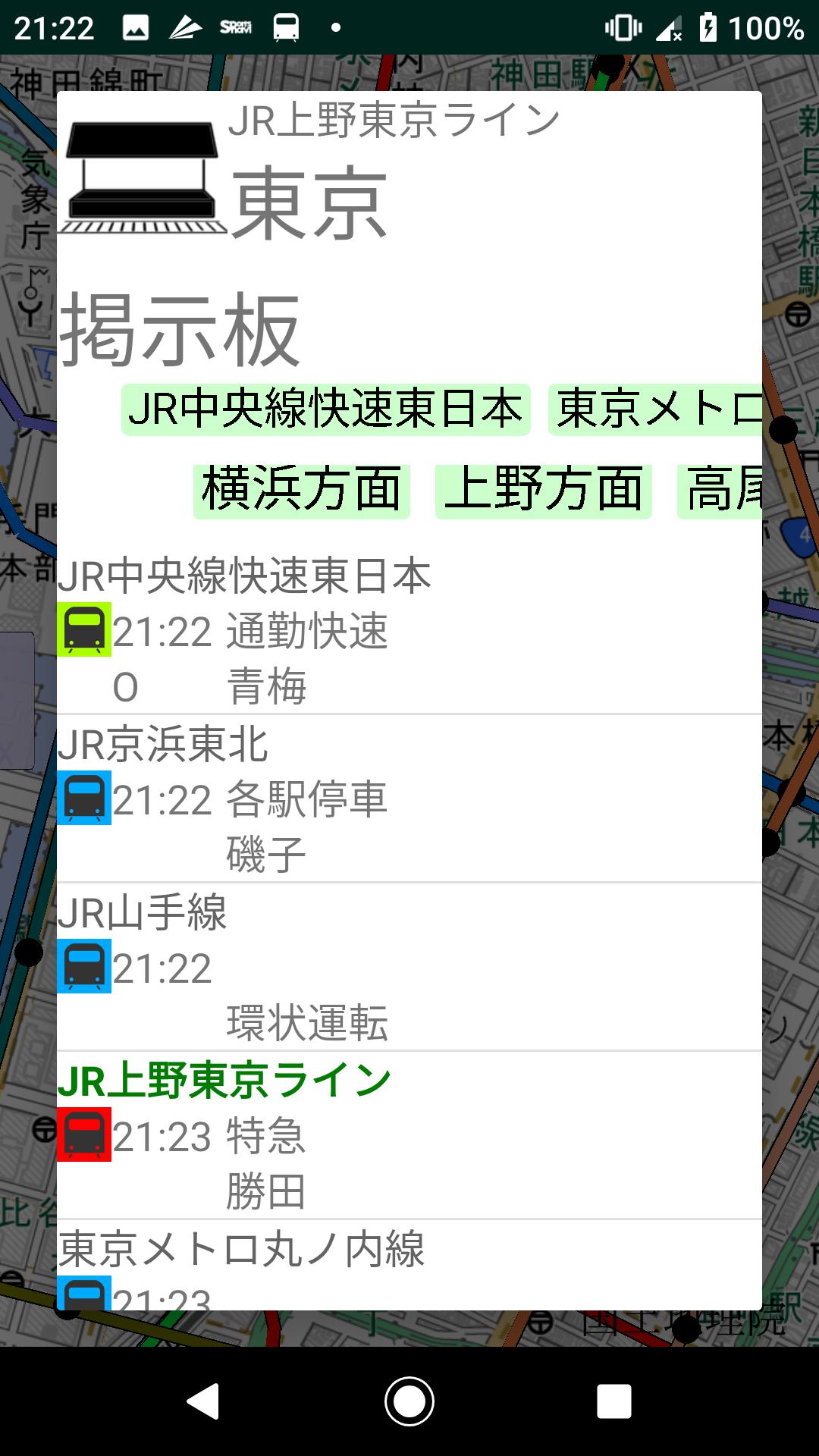
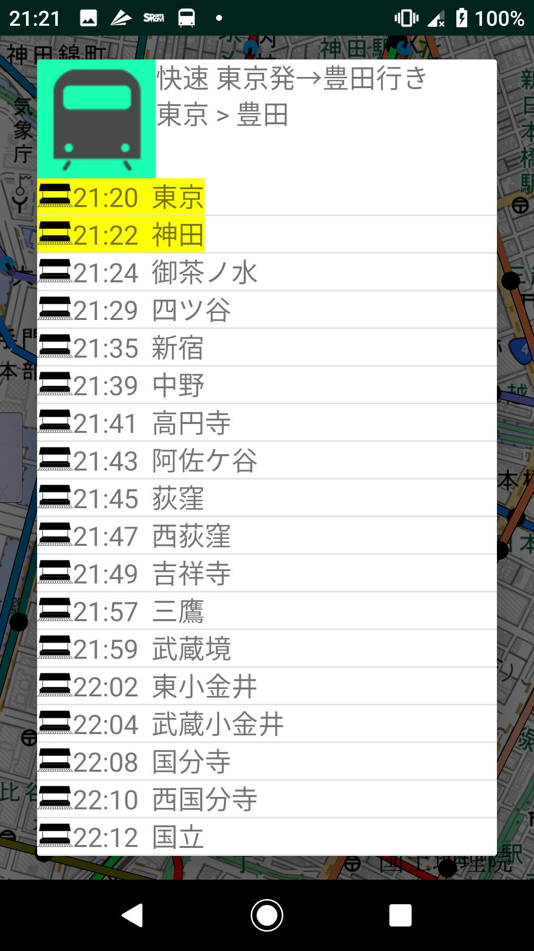
Touch the station or train on the map to display the information.
For stations, a list of departing trains is displayed.
For trains and buses, the departure and arrival times for the entire journey are displayed.
If you select the star mark and then press the route button, the route will be superimposed on the map with blinking white.
The route is added to the route in the slide on the left. Share the content to other apps by touching the added route.
You can also touch in each list, so please try various things.
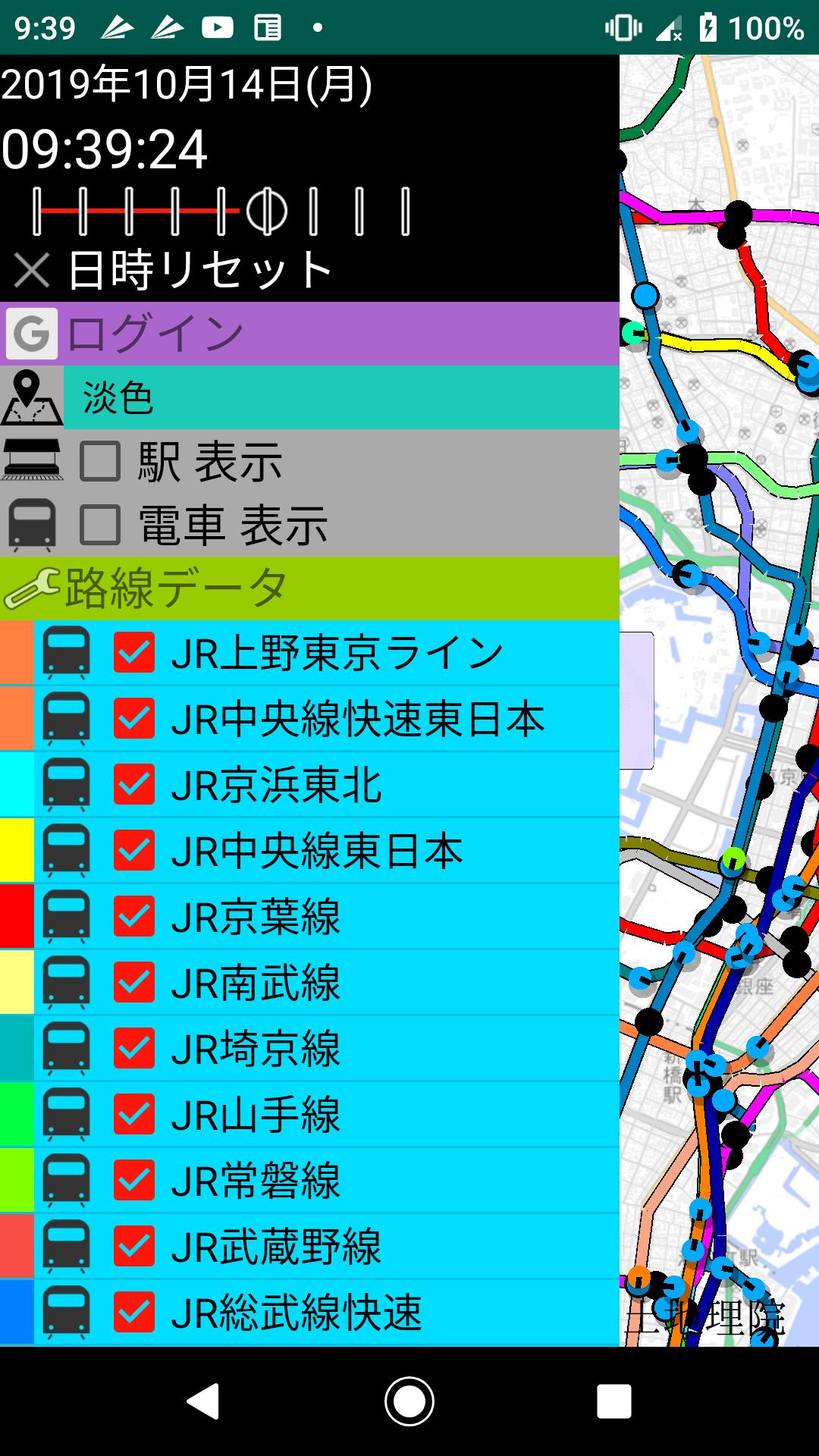
Date and time .. The target time for calculating the train position. You can change the date and time by tapping.
The slide bar below the date and time shows the elapsed speed.
It can be set from 1x speed to 16x speed. Reverse playback is also possible by setting it to the left.
Tap Reset date and time to reset to the current date and time and 1x speed elapsed time.
Map .. You can select several types.
Station display .. You can set whether to display the station name on the map.
Train display .. You can set whether to display the train name on the map.
Route data
[Train mark] .. You can set whether to display the running train.
[Train name check] .. You can set whether to display the route data.
Last updated on Aug 17, 2022
0.6.1 メニュー構成 再構築
Latest Version
![]() 0.6.1
0.6.1
Uploaded by
Yan Lay
Requires Android
Android 8.0+
Available on
![]()
Category
Report
Discover what you want easier, faster and safer.

路線図プラス
0.6.1 by dangerouswoo
Aug 17, 2022